News
Huge Public Support for S2S Proposals emerges from Irish Rail/Jacob Report- July 2026
Irish Rail/ Jacob have recently published an analysis of the results of the Public Consultation process that was conducted in September 2025 on the proposals for the protection of the railway on the east coast between Dublin and Wicklow (ECRIPP). Full details here.
Accelerating Infrastructure. This could be a game changer March 2026
Recent Government move to accelerate infrastructure development has opened up the possibility of combining the S2S in South Dublin Bay with major Infrastructure projects and other local objectives that should command the support of all stakeholders. The proposal arises from the publication of the study of why it takes longer in Ireland to complete major infrastructural projects compared to other European countries. Many of the reasons that were identified are also those that have prevented the construction of the S2S. Among the major deficiencies in the current system are the failure of major agencies to work together and the failure of all agencies to take account of the community interest. Action on these issues could radically change the context in which the S2S has been treated in the past.
In response to this development S2S has updated its previously published proposals to show how the S2S can be the catalyst for integrating all of the objectives into one coordinated project and how that could benefit all stakeholders. See S2S proposal March 2026 here
S2S - Another Missed Opportunity? 2025 and a new proposal for 3m high sea wall will obliterate views from the DART and ignores other national and local objectives. Read the full analysis here.
Read the full analysis HERE.
Submissions on this new proposal can be made to Irish Rail before Monday 13 th Oct here: https://tinyurl.com/DARTwallfeedback
NTA/Irish Rail have published a new plan for the coastal protection of the railway including
the section between Merrion Gates and Dun Laoghaire Harbour. The rock amour solution
that they proposed just a year ago for most of that section has been abandoned. It is now
proposed to demolish the old stone sea wall down to the level of the tracks and replace it
with a crude precast concrete wall which will be 1.3 m higher than the existing wall. That is
higher than the top of the passenger windows in the DART. The existing view of Dublin Bay
will be obliterated forever despite what the sketches and drawings published by Irish Rail
appear to show. On a strategic level, the new proposal takes no account of other national
and local objectives that could and should be integrated into this project.
All of these issues are referred to in greater detail in a paper that the S2S Supporters Group
is now making public HERE. NTA/Irish Rail have requested comments from members of the
public on these proposals to be submitted by Monday 13 th October 2025. Information on
how to make a submission can be found here https://tinyurl.com/DARTwallfeedback
New Proposals for Coastal Protection of the Railway at Blackrock – Make your views known before Wednesday 4 th December 2024
NTA / Irish Rail have recently published proposals for the protection of the East Coast
Railway which includes the section between Merrion Gates and Dun Laoghaire Harbour. A
Community Update issued by the Blackrock Community Group, VRAG (see here) gives a
very good summary of the proposals. For all those who support the idea of a seafront
Walkway and Cycleway there are a number of concerns arising from these proposals.
- For the majority of the route the plan is to simply raise the sea wall by varying amounts
from 0.7 to 1.5m by partially enclosing the existing stone wall in concrete. This will
obscure the view of Dublin Bay from the Dart in some places and obliterate it entirely for
most of the route. There is no provision for either a walkway or cycleway at any point. - In current storm conditions, the waves regularly over-top the sea wall by 3 meters or more. It is difficult to understand how increasing the seawall by 0.7m is an adequate response.
- There are no proposals for any works to be undertaken at sections that also need to be protected at Blackrock Baths, Maretimo, Brighton Vale and Seapoint. Work on these parts should be fully co-ordinated with the works to the railway and executed at the same time. Because they are not directly under the control of Irish Rail, there is no plan as to when or how they will be completed. These works should be co-ordinated.
- S2S has always envisaged the integration of a completely traffic free walkway and cycleway outside the existing sea wall. The proposal would provide better protection for the railway by introducing a buffer zone between the sea and railway while at the same time preserving the view from the Dart. It would be a real gain for the local community and the citizens of Dublin.
Comments should be made before Wednesday 4 th December 2024. Make your views known
to the promoters through the online form at:
https://www.irishrail.ie/en-ie/about-us/iarnrod-eireann-projects-and-investments/ECRIPP/ecripp-pc1
Press Statement on DLR Plans to Abandon S2S
Supporters of the S2S are urged to make a submission to Dun Laoghaire Rathdown Council objecting to this proposal and calling on them to reinstate the S2S on the seafront in the Draft Development Plan 2022-2028. Here is a link to a press-statement that was issued yesterday.
The closing date for submissions is the 16th April 2021. Those wishing to do so may log into the following DLR website and scrolling down to ON-LINE SUBMISSION: https://dlrcoco.citizenspace.com/planning/draftcdp2022-2028/
DLRCC Set to Abandon the S2S - Submissions Required by 16th April 2021
The S2S has been an Objective of DLR Development Plans since 2004. That is now set to change. Dun Laoghaire Rathdown County Council has published a Draft of the Development Plan for 2022-2028. It proposes to abandon the S2S on the seafront and replace it with the East Coast Trail, which is not on the seafront but inland on existing roads and does not include a walkway. The issue is discussed in more detail in the attached paper.
Supporters of the S2S are urged to make a submission to the Council objecting to this proposal and calling on them to reinstate the S2S on the seafront.
The closing date for submissions is the 16th April 2021. Those wishing to do so may log into the following DLR website and scrolling down to on-line submission. https://dlrcoco.citizenspace.com/planning/draftcdp2022-2028/
Dublin Port and the S2S -Dec 2020
The Dublin Port Company has recently published an update to their 2012 Masterplan for the Port. There are major overall improvements to the way the Port operates. This makes it possible to incorporate facilities for pedestrians and cyclists which do not currently exist. The plan proposes a 3.2km pedestrian/cycleway on the entire north coast of the Port along the Tolka Estuary from the existing Ferry Port to Bond Road. It could continue another 900m at the East Wall Business Park to join Alfie Byrne Road (the Tolka Estuary Greenway). It also includes exciting proposals for the critical 1.4km of the S2S that passes through the Port from the River Liffey to the Tolka Estuary (the Liffey-Tolka Project). This would provide a safe, segregated greenway from Thomas Clark Bridge (East Link Bridge) to the existing S2S at Alfie Byrne Road.
The Plan also makes it possible to provide links to other existing and proposed greenways on both sides of the Liffey. On the north there is an opportunity to link directly to the Clontarf seafront with a cycle/pedestrian bridge across the Tolka Estuary. There is also a plan to provide safe pedestrian and cycle links to historic and new visitor attractions within the Port itself.
Dublin City Council have intentions to build a new cycle/pedestrian bridge across the Liffey beside the East Link Bridge. They are also proposing a public transport bridge (including cycle and pedestrian lanes) over the Dodder/Grand Canal outlet to link to Sir John Rogerson’s Quay to Poolbeg and the S2S in the South Bay via Ringsend Park.
The combination and co-ordination of these exciting proposals by the Dublin Port Company, Dublin City Council and Eastpoint Business Park would provide a very good solution to a very challenging set of problems that would satisfactorily complete the S2S at this critical junction of the Port and the city centre and the North and South side of the city. It will transform what is now a hostile environment for pedestrians and cyclists into one that is safe and welcoming.
Here is a link to a short paper that gives more detail on the project
We would like to take this opportunity to wish all our supporters a quiet and safe Christmas!
Kind Regards,
Michael Collins
for
Sutton to Sandycove Walkway and Cycleway
email michael@s2s.ie
New Cycle and Walkways Sandymount to Sandycove - The S2S at last? -August 2020
As the saying goes - it’s an ill wind that blows no good. The Covid 19 pandemic is a case in point. It has inflicted death and misery on communities and seriously damaged economies across the world. Coping with this disaster comes on top of the urgent need to tackle the ever-increasing problems of global warming. The combination of these two has caused us all to think seriously about the way we live, travel, work and play. We should not become despondent however- there are things we can do to turn these problems around.
On the positive side the crises have enabled authorities to experiment with previously unthinkable measures to deal, not only with the Covid 19 pandemic, but also to make it attractive for people to shift from motor cars to walking and cycling so as to reduce carbon emissions and improve their health and welfare. Examples of such experiments are the recent works undertaken by Dun Laoghaire Rathdown County Council (DLRCC) to provide temporary segregated cycleways and improved walkways in Blackrock itself and between Blackrock and Sandycove. Similar measures are also planned by Dublin City Council between Ringsend and Merrion Gates. The transformation has surprised most people. Blackrock has changed from being a place that was dominated by traffic at the expense of pedestrians and cyclists to one in which pedestrians and cyclists can feel relaxed and welcome. While acknowledging that there are some relatively small issues that need to be resolved, the Councils, together with the National Transport Authority, are to be commended for their actions. They must take encouragement from the positive reaction of the local community and traders, many of whom were instrumental in promoting the idea in the first place.
Many people are wondering if these works are part of the missing sections the Sutton to Sandycove Promenade and Walkway (S2S) in South Dublin Bay and can they be regarded as such. The answer is that some parts would form important sections of the S2S while others do not. The 1.8 km section between Dun Laoghaire Harbour and Sandycove would fulfill most of the criteria for the S2S and can be regarded as such. Likewise, the works proposed by DCC for the 2.7 km between Sean Moore Road and Merrion Gates would, depending on the resolution of the outstanding issues and the detailed design, also meet the key criteria. For other sections of the S2S however the temporary works do not fulfill the basic criteria. Those other sections are, nonetheless, to be welcomed as part of the on-road commuter cycle routes. There is no conflict between those on-road sections and the completion of the S2S on the seafront.
It is important to understand the difference between the S2S and the temporary cycleway/walkway that has been created on the existing road between Blackrock and Dun Laoghaire. The S2S in South Dublin Bay was conceived as a combined walkway and cycleway outside the railway line on the seafront. It would be level, noise and pollution free with no traffic junctions, pedestrian crossings nor vehicle entrances and exits. It provides the capability of cycling or walking from Dun Laoghaire to Dublin City center without having to cross paths with motorized vehicles in any significant way. It is envisaged as primarily a leisure/health facility with obvious uses as a traffic free route for children and less experienced cyclists as well as commuter cyclists. It can play a vital role in creating a whole new generation of cyclists in a way that no other facility could do. It gives people the possibility to walk along the edge of Dublin Bay and enjoy the amenity without having to walk on the strand.

These new Covid-19 initiatives - in both DCC and DLR - provide the ideal opportunity to combine the S2S with the necessary Coastal Protection of the railway between Merrion Gates and Dun Laoghaire Harbour and separately to combine the equally important Commuter Cycleway with the Bus Connects project inland on the existing roads. This has successfully been done in other countries, why not here? It is a no brainer as many people would say, and we need to ensure it does happen here.
Michael Collins. email: michael@s2s.ie
for
Sutton to Sandycove Promenade and Cycleway.
Fingal Co Council Shows How It’s Done June 2020
Fingal County have uploaded two small videos (one follows the other) on YouTube to celebrate their success in obtaining planning permission from An Bord Pleanala for the proposed greenway across Malahide Estuary. They are clearly proud of what they have achieved and rightly so.
In welcoming the decision, the Council acknowledged also the support of the National Transport Authority and Irish Rail for the project. The courage of An Bord Pleanala in approving it should also be recognized.
Many skeptics believed that this was not possible because the area through which it passes is designated as a Special Protection Area (SPA) and a Special Area of Conservation (SAC). The project will eventually link to the newly completed section between Baldoyle to Portmarnock Greenway by Fingal County Council, also alongside similarly designated habitats. Eventually Fingal intends to complete the route along the coast all the way from Sutton to Balbriggan.

Given the success of Fingal County Council it, is all the more incomprehensible that the Councils in Dublin City and Dun Laoghaire, with the agreement of the same National Transport Authority and Irish Rail, appear to have abandoned the idea of putting the S2S on the seafront between Merrion Gates and Blackrock, where it could have been combined with the proposed Coastal Protection of the railway. Instead they are pursuing plans to put it on the side of the Merrion Road and through Blackrock Park on the basis that it would not be possible to get permission for such a proposal on the seafront beside and SAC and SPA.
Michael Collins
for
S2S
Malahide Estuary- Important decision by An Bord Pleanala- June 2020
An Bord Pleanala recently approved an application by Fingal County Council to build a walkway and cycleway alongside the railway across the Malahide Estuary. The decision to approve the proposal in an area that is designated as an SAC and an SPA is significant and comes as a welcome surprise to many who believed that such a proposal could not or would not be approved. The decision is important in illustrating how such applications can be successful.

As part of its decision, the Bord concluded - “The development would result in significant positive impacts/benefits on Population and Human Health arising out of the delivery of a recreational amenity, which would bring health benefits by encouraging an active lifestyle in the form of cycling and walking. The proposal would also attract visitors into the area which would result in a positive benefit to tourism and the economy of the area. It would also improve connectivity between Malahide and Donabate. The linking of the proposed greenway into the wider walking and cycle network would be greatly positive in that it would encourage users to arrive by bicycle or foot, reducing car dependency and minimising impacts on existing traffic. As complementary infrastructure is delivered, the proposed development would have a positive cumulative impact.”........
“Impacts on biodiversity including key ecological receptors of wintering water bird species, mammals including bats, natural and seminatural habitats, watercourses, could arise from human disturbance, habitat modification, accidental spillages of construction related contaminants or release of sediment laden water runoff during construction. Mitigation measures to be applied follow a mitigation hierarchy of avoidance where possible and mitigation by design and remedy with monitoring measures also to be implemented. Possible significant disturbance to birds would be prevented due to the timing of construction works, the proposed continuous solid wall providing screening along the viaduct, proposed lighting design and measures including fencing to prevent egress of people and in particular, loose dogs onto the shoreline. Pollution control measures would prevent deterioration of riparian, estuarine and coastal habitats. With the application of mitigation measures, there would be no adverse effects on sites designated for nature conservation including Malahide Estuary SAC and SPA.”
The following further points from the reports and decision are relevant to the S2S:
- The application was very carefully prepared, dealing with all aspects of the issue.
- The decision of the Bord was to accept the Inspectors report and recommendations in full which in turn accepted the report of the Bord’s Ecologist.
- Despite expressions of concern in some submissions about the possible negative impact on the SAC and SPA, the decision is clear and unambiguous in accepting that the project will have no such negative impact.
- It was accepted that the birds are disturbed by dogs running loose and not by people walking or cycling along a pathway that is separated from the habitat by a wall that is 1.2 m high.
- It was accepted the benefits to the environment and the health and welfare of the community of a traffic free cycleway and walkway were significant and were a factor in the decision to approve
- It was also acknowledged that the proposed facility would be significant in promoting the modal shift from car transport to cycling and walking.
- The benefits for tourism and the local community was also noted as important.
- The fact that Fingal County Council had included the development of a cycleway and walkway across the estuary as an objective in their current Development Plan was also a significant supporting factor.
So, will this decision affect the prospects for the S2S in South Dublin Bay? While it must be noted that An Bord Pleanala decides each case on its merits, there are a great number of similarities between the two projects.
- Both the Malahide Estuary project and the S2S involve the construction of a cycleway and walkway alongside an existing railway line.
- The Malahide Estuary and South Dublin Bay are both designated as an SPA and SAC.
- Possible disturbance of the birds during construction and in use are the main issues for consideration.
- All of the issues that have been raised as concerns in relation to the S2S have also been raised and resolved in the case of the Malahide Estuary.
- Most of the mitigation measures adopted for the Malahide Estuary project have already been proposed for the S2S in South Dublin Bay.
It will take some time to study the decision in detail but what is clear is that, despite the view that is widely held in some quarters, it is possible to obtain an approval from An Bord Pleanala for such projects provided the application is clear and comprehensive and demonstrates that there is no significant negative impact on the habitats. This application shows how that can be achieved.
The following is a link to the decision documents http://www.pleanala.ie/casenum/304624.htm
Michael Collins
for S2S
S2S - Public Information Meeting 22nd October 2019
A meeting has been arranged by DLRCC COUNCILLOR BARRY WARD, to be held in the ROYAL MARINE HOTEL, DUN LAOGHAIRE, on TUESDAY 22ND OF OCTOBER AT 7.30PM.
The purpose of the meeting is to provide members of the public with an update on the progress of the Sutton to Sandycove Promenade and Walkway project. Everyone who is interested in the project is welcome to attend. Speakers will provide information on the current state of the project, the opportunities to enable it to go ahead and the obstacles that have to be overcome in order to do so.
Michael Collins for S2S
Fun Family Cycle Event – Blackrock – Sunday October 6th 2019 at 10.00am
As part of the Festival of Inclusion 2019 the Dublin Cycling Campaign (DLR Branch), together with Cycling Without Age, have arranged a fun cycle from the bandstand in Blackrock Park to Merrion Gates and back to the bandstand at Blackrock. The event starts at 10.00am. The route is 4kms long and will have marshals at key locations to make it safe for families. Bicycles, tricyles, scooters, trishaws, rickshaws .... all are welcome!
The route for the event is the one currently proposed in the Bus Connects plans for the S2S cycleway, instead of the route along the seafront, originally sought by the S2S group and as contained in the current development plans of Dublin City and Dun Laoghaire Rathdown Councils.
Support Needed Now - May 2019
The Sutton to Sandycove Promenade and Cycleway (S2S) proposes a 22km traffic free, level, walkway and cycleway on the seafront around Dublin Bay. The section from Sutton to East Wall is complete since 2017, but nothing has been achieved so far in Dublin Bay South. That is about to change. Within the past year or so, the National Transport Authority (NTA) has commissioned three different studies, each of which relates in some way to the (S2S) project. They are: (a) Bus Connects, (b) the Coastal Protection of the Railway and (c) the S2S between Dun Laoghaire and Sandymount. There appears however to be little co-ordination between these bodies in relation to the S2S. The published plans for the Bus Connects show the S2S, not on the seafront, but on the Merrion Road between Booterstown and Merrion Gates and there is no instruction to Irish Rail to consider it on the seafront as part of their Coastal Protection project. The case for considering the S2S with the Coastal Protection of the Railway is compelling and we are at a loss to understand why that is not being considered. We attach a paper that sets out the case for doing that here. We are convinced that, if this approach is not taken, a unique opportunity to complete the S2S as an unbroken traffic free, environmentally friendly walkway and cycleway on the seafront in the South Dublin Bay will be lost for at least a generation, if not forever. The NTA has sought submissions from the public on the Bus Connects proposals, to be submitted by the 31st May. Details can be found here . Supporters who believe that the S2S should be on the seafront and not on the Merrion Road, should make a submission to NTA before the deadline.
Funds allocated for part of the S2S in South Dublin Bay – February 2019
 Councillor Ossian Smyth (Green Party) Cathaoirleach, Dun Laoghaire Rathdown County Council (DLRCC) has announced that €17.5m has been allocated by the National Transport Authority (NTA) for the section of the East Coast Greenway between Merrion Gates and Dun Laoghaire Harbour. This is very welcome news.
It is proposed that 2.5kms of the route between Merrion Gates and Blackrock will be inside the railway line, partly on the Merrion Road and partly in Blackrock Park which is not the route planned for the S2S while the remaining section between Blackrock and Dun Laoghaire Harbour will be on the seafront which coincides with the planned route for the S2S.
NTA have also agreed with Dublin City Council (DCC) to proceed to the next stage of the Greenway between Ringsend and the Merrion Gates. This is also on the seafront and coincides with the planned route for the S2S.
DCC and DLRCC have been working independently on the preliminary stages up to now but it has been agreed that the two councils will cooperate on the next stages and that the work will be led by DLRCC on behalf of both. As a preliminary step, bird counts have commenced along the coast from Ringsend to Dun Laoghaire. The process of drafting a brief on which tenders will be sought for the full environmental study and design work has started. This is also a positive news.
In a completely separate development, Irish Rail (also with the support of NTA) have announced that it is undertaking a study of the coastal protection of the Dublin-Rosslare railway line. This study includes the 4.5kms of coastline from Merrion Gates to Dun Laoghaire which coincides with the proposed route for the S2S.
There is therefore a significant overlap between Coastal Protection Project being pursued by Irish Rail with the Greenway project being undertaken by DCC and DLRCC. There are a number of potential benefits for both in co-operating on these projects. It is not clear however what co-ordination is occurring. It is to be hoped that if it is not already happening it will happen soon.
Michael Collins for S2S
Councillor Ossian Smyth (Green Party) Cathaoirleach, Dun Laoghaire Rathdown County Council (DLRCC) has announced that €17.5m has been allocated by the National Transport Authority (NTA) for the section of the East Coast Greenway between Merrion Gates and Dun Laoghaire Harbour. This is very welcome news.
It is proposed that 2.5kms of the route between Merrion Gates and Blackrock will be inside the railway line, partly on the Merrion Road and partly in Blackrock Park which is not the route planned for the S2S while the remaining section between Blackrock and Dun Laoghaire Harbour will be on the seafront which coincides with the planned route for the S2S.
NTA have also agreed with Dublin City Council (DCC) to proceed to the next stage of the Greenway between Ringsend and the Merrion Gates. This is also on the seafront and coincides with the planned route for the S2S.
DCC and DLRCC have been working independently on the preliminary stages up to now but it has been agreed that the two councils will cooperate on the next stages and that the work will be led by DLRCC on behalf of both. As a preliminary step, bird counts have commenced along the coast from Ringsend to Dun Laoghaire. The process of drafting a brief on which tenders will be sought for the full environmental study and design work has started. This is also a positive news.
In a completely separate development, Irish Rail (also with the support of NTA) have announced that it is undertaking a study of the coastal protection of the Dublin-Rosslare railway line. This study includes the 4.5kms of coastline from Merrion Gates to Dun Laoghaire which coincides with the proposed route for the S2S.
There is therefore a significant overlap between Coastal Protection Project being pursued by Irish Rail with the Greenway project being undertaken by DCC and DLRCC. There are a number of potential benefits for both in co-operating on these projects. It is not clear however what co-ordination is occurring. It is to be hoped that if it is not already happening it will happen soon.
Michael Collins for S2S
S2S - New Plans Proposed -May 2018.
Following a meeting between The National Transport Authority (NTA) and Councillors from Dublin City Council, (DCC) and Dun Laoghaire Rathdown Co Council (DLRCC), agreement has been reached on a new approach to advance the S2S project. This would complete two further sections on the seafront; one between Irishtown and Merrion Gates and the other between Blackrock and Seapoint and is an exciting prospect for supporters of the S2S. The agreement follows the publication of a study carried out by the NTA in 2016 and public comments on it in January 2017. While much of what is now proposed remains the same as the 2016 proposals, there are also significant differences that seek to address the most contentious parts of those proposals:
- A new cycleway alongside the existing promenade on the seafront between Sean Moore Park and Merrion Gates, as before. (c 2.0kms)
- The proposed flyover at Merrion Church/ Merrion Hall to allow the permanent closure of the Merrion Gates will not now proceed. It is acknowledged that there will be increased delays to road traffic when the frequency of Dart services increases in September 2018. There appears to be no viable solution to the problem at this time.
- Provide improved cycle ways and footpaths on the Rock Road between Merrion Gates and Booterstown Dart Station, as before.
- Improve the existing shared cycleway and walkway through Blackrock Park between Booterstown Station and Blackrock, as before.
- The 2016 proposal to make Seapoint Ave one-way for road traffic will not now proceed. A new seafront walkway and cycleway will be provided between Blackrock and Seapoint in place of the walkway (only) on the seafront. (c1.2kms)
- It is proposed that (with the support of the NTA) Dublin City Council and Dun Laoghaire Rathdown Council will proceed with the development of these proposals under Part 8 of the Planning Acts. This sets down the procedures for local authorities to carry out public works within their own areas and will involve development of the designs and the necessary environmental studies as the first steps.
- The NTA has undertaken to provide funding for the project.
 Part of the new route between Blackrock and Maretimo which will be behind the sea wall.[/caption]
While supporters of the S2S will be disappointed that the whole of the route is not on the seafront and that the proposals in respect of the section between Merrion Gates and Blackrock are less than ideal, it has to be acknowledged that these new proposals will see the completion of approximately 3.2 kms of the amenity on the seafront. This would be the first section of the S2S to be undertaken in South Dublin Bay and a significant step towards the achievement of the overall project, for which we should all be grateful to the NTA and the Councils of DCC and DLRCC. We hope everyone will get behind this initiative.
Further information can be found in this article by Olivia Kelly in the Irish Times of 4th June 2016
Michael Collins and Clara Clark
for: Sutton to Sandycove Promenade and Cycleway
Part of the new route between Blackrock and Maretimo which will be behind the sea wall.[/caption]
While supporters of the S2S will be disappointed that the whole of the route is not on the seafront and that the proposals in respect of the section between Merrion Gates and Blackrock are less than ideal, it has to be acknowledged that these new proposals will see the completion of approximately 3.2 kms of the amenity on the seafront. This would be the first section of the S2S to be undertaken in South Dublin Bay and a significant step towards the achievement of the overall project, for which we should all be grateful to the NTA and the Councils of DCC and DLRCC. We hope everyone will get behind this initiative.
Further information can be found in this article by Olivia Kelly in the Irish Times of 4th June 2016
Michael Collins and Clara Clark
for: Sutton to Sandycove Promenade and CyclewayBoost for S2s following DLRCC Elections -
In his acceptance speech following his election as Cathaoirleach of Dun Laoghaire Rathdown County Council Cllr on 19th June 2017, Cllr Tom Murphy made the completion of the S2S his first priority:
“I suppose some of the things I’d like to see happen during my term of office and which I’d like to promote. The first item I would like to see us promoting is the S2S; I think that it is really important that’s progressed very far throughout Dublin itself. We’re very important and one of the final links of that and it’s something I think all the Members will agree that it would be something that would be fantastic from a tourism point of view but also linking the city and the people in general and we’d all like to promote.. “
Cllr Kate Feeney, who is a long term supporter of the S2S project, was elected Leas-Cathaoirleach and she also supported the project in her inauguration speech. Their statements are a welcome confirmation of the support that continues to exist across all of the main political parties for the S2S project. Backing at this level within the Council will be crucial in furthering the project in the next 12 months.
[caption id="attachment_793" align="aligncenter" width="297"]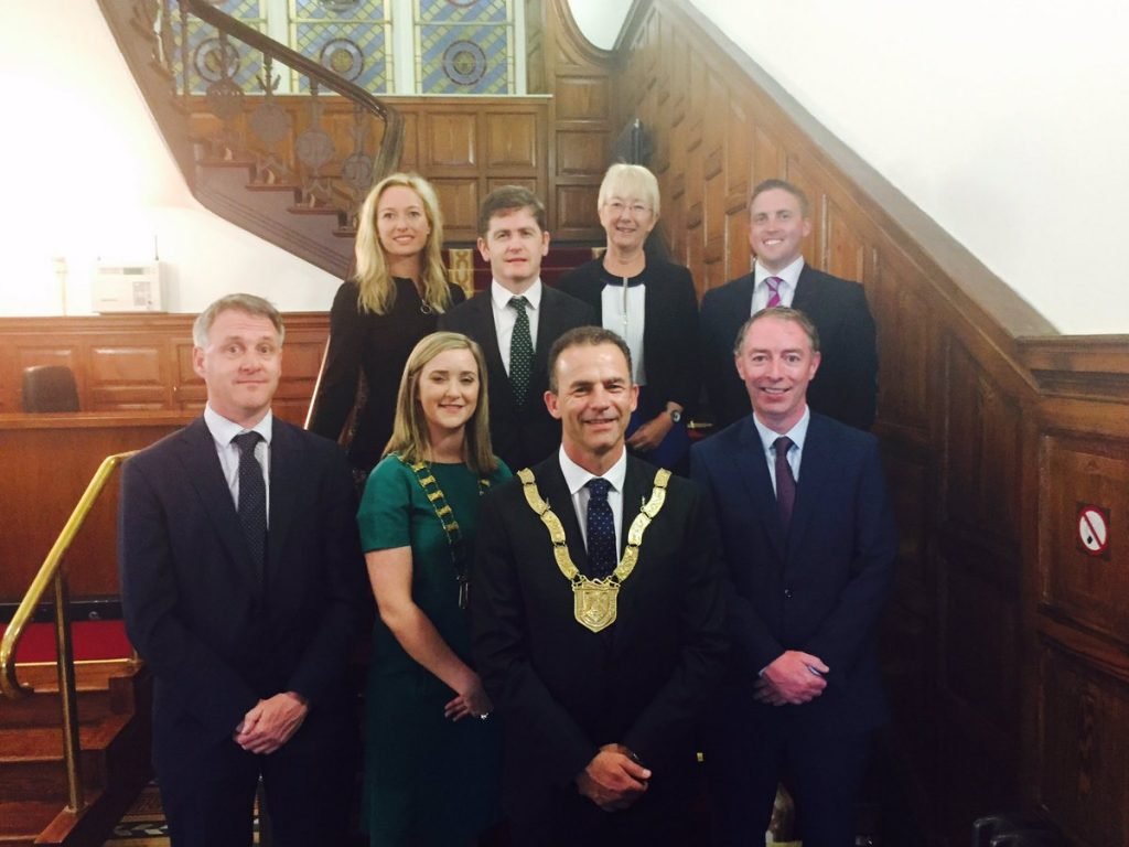 Cllr Tom Murphy and Cllr Kate Feeney with colleagues following their election in DLRCC.[/caption]
We congratulate both Cllr Murphy and Cllr Feeney on their election and wish them well in their term of office.
Cllr Tom Murphy and Cllr Kate Feeney with colleagues following their election in DLRCC.[/caption]
We congratulate both Cllr Murphy and Cllr Feeney on their election and wish them well in their term of office.
Irish Times reports by Olivia Kelly on S2S
Two excellent articles by journalist Olivia Kelly in the Irish Times Saturday 6th May following the opening of the Dollymount Section of the S2S. They are also on the I.T. website at the following links: Missing link’ in Dublin Bay cycle path opens in Clontarf How 2km of cycle path in Clontarf became a 25-year saga
S2S Dollymount Opens -5th May 2017
Today the Lord Mayor of Dublin Brendan Carr formally opened the 2Km stretch of the S2S between the Wooden Bridge and the Causeway to the Bull Island. For supporters of the S2S it was a momentous occasion, being the first section to be completed since the campaign was started in 2001. There is now a continuous off- road walkway and cycleway all the way from Sutton to East Wall. Fantastic!
[caption id="attachment_775" align="aligncenter" width="584"] Lord Mayor Brendan Carr Cuts the Tape[/caption]
[caption id="attachment_777" align="aligncenter" width="584"]
Lord Mayor Brendan Carr Cuts the Tape[/caption]
[caption id="attachment_777" align="aligncenter" width="584"] Among the attendance: Ciaran Cuffe (Dublin City Council), Clara Clark (S2S & Cycling Without Age) and Colm Ryder (Dublin Cycling Campaign).[/caption]
Cycling Without Age comes to Ireland!
Cycling Without Age is a Danish concept created in 2012 www.cyclingwithoutage.org). The idea is to take residents of nursing and care homes out for a spin on a specially designed rickshaw bicycle, piloted by volunteer cyclists. Clara Clark & Charles Mollan were granted the first Irish royalty-free licence. Clara is a long-time S2S group member.
 The first rickshaw bike arrived in Dublin on Monday, 13th March 2017. We were delighted to take up the invitation from the Dublin Cycling Campaign to participate in the Dublin St Patrick’s Day Parade under the banner of 200 Years of Cycling. See the photo of us at the start of the parade. We purchased this first bike from personal funds, so as to have a model to demonstrate to nursing homes and sponsors. We hope to have this bike crowd-funded.
Now that we have the bike here, we will be happy to talk to people, organisations, nursing homes, potential sponsors and others about how to promote the concept of Cycling Without Age (www.cyclingwithoutage.ie) here. We already have expressions of interest from some sponsors and organisations, and offers from volunteer pilots, whom we will train in the bike’s use. Please let us know if you would like more information.
Clara Clark & Charles Mollan
www.cyclingwithoutage.ie
clara@claraclark.ie
Tel: 087-2515439; 01-2898533
17 Pine Lawn, Newtownpark Avenue, Blackrock, Co. Dublin
The first rickshaw bike arrived in Dublin on Monday, 13th March 2017. We were delighted to take up the invitation from the Dublin Cycling Campaign to participate in the Dublin St Patrick’s Day Parade under the banner of 200 Years of Cycling. See the photo of us at the start of the parade. We purchased this first bike from personal funds, so as to have a model to demonstrate to nursing homes and sponsors. We hope to have this bike crowd-funded.
Now that we have the bike here, we will be happy to talk to people, organisations, nursing homes, potential sponsors and others about how to promote the concept of Cycling Without Age (www.cyclingwithoutage.ie) here. We already have expressions of interest from some sponsors and organisations, and offers from volunteer pilots, whom we will train in the bike’s use. Please let us know if you would like more information.
Clara Clark & Charles Mollan
www.cyclingwithoutage.ie
clara@claraclark.ie
Tel: 087-2515439; 01-2898533
17 Pine Lawn, Newtownpark Avenue, Blackrock, Co. Dublin

![]()
New Electric Bike Tours from Dublin City to Howth to use the S2S
![]() In an exciting new development, Electric Bike sellers Greenaer are planning to use the S2S route for their new venture which introduces guided tours from Dublin City center along the coastal route to Howth. They are expecting to start with an industry led focus group on the 4th April from their base in just off Pearse St. Dublin 2 heading to Howth. Director of the company, Olivier Vander Elst is confident that they will be making great use of the infrastructure. The announcement confirms what supporters of the S2S project have always believed - when completed, the S2S has enormous potential as an attraction and an amenity for Dubliners and visitors to the city. We have no doubt that the venture will be a great success and wish them well.
In an exciting new development, Electric Bike sellers Greenaer are planning to use the S2S route for their new venture which introduces guided tours from Dublin City center along the coastal route to Howth. They are expecting to start with an industry led focus group on the 4th April from their base in just off Pearse St. Dublin 2 heading to Howth. Director of the company, Olivier Vander Elst is confident that they will be making great use of the infrastructure. The announcement confirms what supporters of the S2S project have always believed - when completed, the S2S has enormous potential as an attraction and an amenity for Dubliners and visitors to the city. We have no doubt that the venture will be a great success and wish them well.
S2S Briefing - All you need to know on Two pages.
What is the S2S? Why is in the News? Why is it worth supporting?. Check out this short briefing document:- 161124-s2s-briefing-paper-nov-2016
Great Meeting of S2S Supporters 15th November 2015
We thank the large number of Supporters and Public Representatives that attended the meeting in the Tara Towers Hotel on 15th November. There was a presentation of the proposals for the Sandymount/Merrion/Blackrock Study s2s-presentation-nov-2016 and a lively discussion of the issues. In the end, there was consensus around the following resolution: 1: Accept the proposals as a significant step forward. 2: Express the hope that the required environmental assessments would demonstrate that the need to protect birds/ habitats can be reconciled with the provision of (a) sustainable transport systems and (b) access to amenity for the community. 3: Work towards the provision of a fully coastal cycle / pedestrian route as the preferred option. It is expected that the NTA will hold public meetings on the proposals on the 22nd and 23rd of November in the Tara Towers Hotel. Supporters of the S2S Project are urged to attend those meetings and contribute in support of the project. Note: 16th December 2016: Final Date for the submission of comments to the NTA
NTA Report - Initial Comments and Notice of Meeting
Supporters of the S2S Project are invited to a meeting which will be held on Tuesday 15th November at 7.30 pm in the Tara Towers Hotel, Merrion Road. The purpose of the meeting is to explain the proposals and the background in more detail and to discuss the approach we will take to the submission which must be submitted before the 16th December 2016. We attach a paper in which we present our initial analysis and reaction to the report and hope that you will find helpful in understanding the proposals and issues. A copy of the paper may be found here: s2s-initial-comment-on-the-sandymount-blackrock-study-nov-2016 If you wish to read the NTA report in full and check the supporting documents, please go to the following NTA website.https://www.nationaltransport.ie/consultations/nta-opens-consultation-on-ambitious-proposals-to-tackle-merrion-gate-bottleneck/
New Plan for S2S in South Dublin Bay – October 2016
Supporters of the S2S project will welcome the publication by the Department of Transport, Tourism and Sport of a new plan for a cycleway and pedestrian walkway between Sandymount and Seapoint along Dublin Bay. A copy of the summary report may be found at the following link: https://www.nationaltransport.ie/consultations/nta-opens-consultation-on-ambitious-proposals-to-tackle-merrion-gate-bottleneck/
 The report seeks to resolve many of the issues that have prevented the S2S project from proceeding for the past ten years and comes up with a number of novel solutions. Among the challenges that the authors have addressed is the bottleneck at the Merrion Gates. The solution which would replace the existing level crossing with a bridge over the railway some 200m north of the existing gates, is most imaginative. There are many other very good ideas and proposals for most parts of the S2S route although there will be some disappointment that a solution has not been found which would allow it to be constructed on the seafront for the section between Merrion Gates and Blackrock.
A more detailed comment on the report will be published here in the coming days when we have had time to consider the documents.
Admin S2S
The report seeks to resolve many of the issues that have prevented the S2S project from proceeding for the past ten years and comes up with a number of novel solutions. Among the challenges that the authors have addressed is the bottleneck at the Merrion Gates. The solution which would replace the existing level crossing with a bridge over the railway some 200m north of the existing gates, is most imaginative. There are many other very good ideas and proposals for most parts of the S2S route although there will be some disappointment that a solution has not been found which would allow it to be constructed on the seafront for the section between Merrion Gates and Blackrock.
A more detailed comment on the report will be published here in the coming days when we have had time to consider the documents.
Admin S2S
S2S - What’s Happening? 14th Feb 2016
Supporters wishing to raise the matter of the matter of the S2S project with politicians canvassing their support in the coming elections and may be wondering about progress, or the lack of it. The following is the position as of the beginning of 2016- fifteen years since the idea was first proposed. The project can be broken into three main sections- the North Bay from Sutton to East Wall, the South Bay from Sandymount to Dun Laoghaire and the City Centre section from Alfie Byrne Road to Sean Moore Road. The North Bay. Of the 9kms from Sutton to Alfie Byrne Road, all but 2kms of promenade and cycleway exists in some shape or form. Work started at the end of 2014 on the missing 2kms section between the Wooden Bridge and the causeway at Dollymount. The creation of the walkway and cycleway for this section was combined with the laying of a major water main (needed to complete the north city ring main) and the improvement in the flood defences. The works were stopped in mid-2015 following protests by local residents about the height and finish of the new sea wall. Following discussions between representatives of the community and Dublin City Council, a further issue emerged with regard to DCC’s entitlement to continue with the works during the winter months. It is understood that an accommodation was reached whereby work would be suspended on the sea wall but could continue on the water main and the cycleway and footpath, until the other matters were resolved. That remains the position. It is reported in the Irish Times of 12th Feb that in a draft report seen by that newspaper, Dr. Jimmy Murphy of University College Cork, who was engaged by the council to review the height of the flood defense wall, suggested it be reduced by 10cm-20cm. It is also understood that sections of the concrete wall may be clad in granite. It is hoped that the difficulties will be sorted out and the new section will be open in 2016. This will provide a continuous traffic free cycleway from Sutton to East Wall and complete the northern section of the project which is a major step in completing the overall project. The South Bay It is approximately 9kms from Ringsend to Sandycove. There is at present no seafront cycleway for approximately 4kms between Sean Moore Road and Seapoint. The existing promenade at Sandymount, which is very popular with residents and visitors means that there is less new walkway to be provided. The missing section has proved to be difficult, mainly because of the issues to do with the designation of the entire area of South Dublin Bay a habitat for seabirds. At the heart of the difficulties is the discussion as to the relative importance of Dublin Bay as a habitat for seabirds as against the potential of providing a traffic-free cycleway and promenade from Sandycove to the City Centre on a miniscule part of the overall area. The project would provide significant benefits for the environment. It would also allow the citizens and visitors to reconnect with the Bay in a manner that has not happened for 60 years. At the end of 2014 the National Transport Authority with the support of Dublin City Council and Dun Laoghaire Rathdown County Council appointed consulting engineers AECOM + Roughan & O’Donovan (AECOM-ROD) along with Scott Cawley (Ecology Consultants) to undertake a new design and environment scoping study of the proposal. It is understood that a draft report was completed and submitted to the NTA by the summer of 2015. A presentation of the draft report was given to members of a joint committee of Councillors from DCC and DLRCC in October2015. The report has not yet been published however and the reason is not clear. It is to be hoped that will happen soon and that it will provide a way forward with this section of the route. The City Centre Dublin City Council plans to construct two new pedestrian/cycleway bridges to the east of the Samuel Beckett Bridge which will connect the North Side to the Grand Canal Docks area. There is also the possibility of upgrading the East Link Bridge by adding a boardwalk to the upstream side of the deck. It has also been a long term objective of the Council to build a bridge across the Dodder /Grand Canal Gut, where it meets the Liffey. A new bridge in this location would link Sir John Rogerson’s Quay with Ringsend and on to Sandymount for cycles and pedestrians. It would also be used for public transport, but not private cars or trucks. The Greater Dublin Area Cycle Network Plan published by the NTA has identified several potential routes in this section including through Ringsend Park and connections to the River Dodder Greenway and the Royal Canal Greenway with links through the East Wall area. There are therefore a number of possible routes to connect the North and South sections of the S2S and it is possible that DCC will provide more than one route through this section to facilitate better access for cyclists and walkers to the growing commercial centre of Dublin. Other Developments Aside from these developments, the proposal to develop an East Coast Greenway extending from Drogheda to Arklow (with the S2S at the heart of it), has gained widespread public support. It is likely to be incorporated in most, if not all, of new Local Authority Development Plans which will be adopted in the next couple of years. Plans by Fingal County Council to construct a section of this across the Malahide Estuary are already well advanced. When completed, this will provide a significant boost to the overall vision. In summary, progress has been painfully slow. The works to complete the northern section of the route are stalled. While there is work going on behind the scenes to come up with practical proposals for the city centre and the south bay sections, no actual plans have been published. The project needs all the community and political support that it can get and supporters are asked to let the politicians know their views on the importance of the project. Michael Collins (michael@s2s.ie) For S2S
Councillors view Blackrock section of S2S route - September 2015
 A group of Councillors from Dun Laoghaire Rathdown County Council and Dublin City Council walked a part of the possible route for the S2S near Blackrock on Saturday 19th September at low tide. The group, all of whom are members of the Joint Committee set up by councillors from Dublin City and Dun Laoghaire, included (L-R); Cllr Barry Ward (DLRCC), Cllr Kate Feeney (DLRCC), Christopher Manzira (DCC), Cllr Melisa Halpin DLRCC, Cllr Deirdre Kingston (DLRC). They are pictured here with Anne Devine (DLRCC)be and Clara Clarke (S2S).
The purpose of the walk was to allow the Councillors to acquaint themselves with the challenges and opportunities that the project presents in the context of the new study of the project which is being undertaken by the National Transport Authority. Members of the group expressed their support for the project, citing its attractions as a public amenity and facility for commuter and leisure cyclists. Its potential to provide members of the community and visitors with the possibility of enjoying the Bay and it birdlife without having to walk on the beach and disturb the birds. Some saw it as presenting a new beginning for Dublin and its relationship to the Bay.
Everyone is anxious to see the outcome of the study by the National Transport Authority but there is as yet no indication as to when it will be published.
A group of Councillors from Dun Laoghaire Rathdown County Council and Dublin City Council walked a part of the possible route for the S2S near Blackrock on Saturday 19th September at low tide. The group, all of whom are members of the Joint Committee set up by councillors from Dublin City and Dun Laoghaire, included (L-R); Cllr Barry Ward (DLRCC), Cllr Kate Feeney (DLRCC), Christopher Manzira (DCC), Cllr Melisa Halpin DLRCC, Cllr Deirdre Kingston (DLRC). They are pictured here with Anne Devine (DLRCC)be and Clara Clarke (S2S).
The purpose of the walk was to allow the Councillors to acquaint themselves with the challenges and opportunities that the project presents in the context of the new study of the project which is being undertaken by the National Transport Authority. Members of the group expressed their support for the project, citing its attractions as a public amenity and facility for commuter and leisure cyclists. Its potential to provide members of the community and visitors with the possibility of enjoying the Bay and it birdlife without having to walk on the beach and disturb the birds. Some saw it as presenting a new beginning for Dublin and its relationship to the Bay.
Everyone is anxious to see the outcome of the study by the National Transport Authority but there is as yet no indication as to when it will be published.
Work Starts on Dollymount Section of S2S May 2015
The Irish Tomes reports today, 20th May, that construction of the €5 million“missing link” of the Dublin Bay cycle path is starting this week, more than a decade after planning of the route began. http://www.irishtimes.com/news/environment/work-on-5m-clontarf-section-of-dublin-bay-cycle-path-starts-1.2218425
Work to start on 2Kms of S2S near Bull Island in 6 weeks! - the Irish Times 17th Feb 2015.
The first actual construction since the project was first proposed in 2001. Congratulations and thanks to Dublin City Council, the Department of Transport and Tourism and the National Transport Authority for this major step forward. http://www.irishtimes.com/news/environment
Councillors appoint members of S2S Joint Committee -Feb 2015
Councillors of Dún Laoghaire-Rathdown County Council and Dublin City Council have set up a Joint Committee to promote the S2S project. On their own initiative, the Councillors have completed the necessary procedures to establish a joint committee to co-ordinate their actions in support of the project. The move came with the support of all of the main political parties. The purpose of the committee is to co-ordinate the response of the Councillors to the new feasibility study of the project that is being undertaken on behalf of the National Transport Authority. The study is focussed on the missing section of the Sutton to Sandycove Promenade and Cycleway between Sandymount and Seapoint. It is expected that a draft report will be published for public consultation in March 2015. The membership of the joint committee are as follows: The Dún Laoghaire-Rathdown members are: Deirdre Donnelly (Independent – Stillorgan) Kate Feeney (Fianna Fáil – Blackrock) Melissa Halpin (People before Profit – Dún Laoghaire) Deirdre Kingston (Labour – Blackrock) Ossian Smyth (Green Party – Dún Laoghaire) Barry Ward (Fine Gael – Blackrock) The Dublin City members are: Kieran Binchy (Fine Gael – Pembroke South-Dock) Claire Byrne (Green Party – Pembroke South-Dock) Mannix Flynn (Independent – Pembroke South-Dock) Jane Horgan-Jones (Labour – Clontarf) Frank Kennedy (Fianna Fáil – Pembroke South-Dock) The action by the Councillors is clear evidence of the strong support that continues to exist in the main political parties. It is to be hoped that members of the community who support this great project will indicate that to the Councillors. S2S Admin Team
Renewed Prospects for S2S in 2015 - January 2015
Just when it appears that everyone in authority has forgotten about the Sutton to Sandycove Promenade and Cycleway, something unexpected happens. The National Transport Authority with the support of Dublin City Council and Dun Laoghaire Rathdown County Council have recently appointed consulting engineers AECOM + Roughan & O’Donovan (AECOM-ROD) along with Scott Cawley (Ecology Consultants) to undertake a new design and environment scoping study of the the proposal. The study is focussed on the only remaining 4kms which is missing on the seafront in the South Dublin Bay. It covers approximately 1km at Sandymount to link Sean Moore Park with the promenade at the Beach Road and approximately 3km from Merrion Gates to Seapoint. The appointments follow on the completion of a study and proposals by the NTA for the future development of a network of cycleways for the whole of the Greater Dublin Region which were published in 2013 (Draft Greater Dublin Area Cycle Network Plan (NTA, 2013). It identified a number of potential “Greenways”- routes that could be established in scenic or otherwise undeveloped areas and which could act as route for leisure as well as commuter cycling. One such Greenway, known as the East Coast Trail is proposed to run along the coast from Drogheda to Arklow. The section in Dublin Bay, coincides with the route of the S2S which was first put forward in 2001. It is understood that the new study is already underway. It is expected that a draft will be published in March 2015 and members of the public will be invited to comment on the findings and recommendations. In an unusual act of solidarity, Councillors from across the political spectrum in both Dublin City Council and Dun Laoghaire Rathdown County Councils have agreed to form a joint committee to support the project. This is a most exciting and welcome development. The issues, most particularly those to do with the designation of South Dublin Bay as a Special Area of Conservation (SAC) and an Area of Special Protection (SPA), remain to be resolved. The study now commissioned by the NTA however represents the best opportunity to find solutions that will allow this wonderful project to proceed and we should be grateful to the NTA for taking this initiative. There is little doubt that a positive outcome would be welcomed by the local communities and those citizens with an interest in promoting cycling and healthy living. S2S Admin Team January 2015
National Bike Week Photocall Event in support of S2S. Booterstown Dart Station, Wednesday 18th June at 1.00pm. People, Families, Walkers and Cyclists, all Invited to Attend.
As part of National Bike Week and following on the recent Local Government elections, the event has been arranged to allow supporters of S2S to show their support for the project and to meet some of the newly elected councillors whose support is also needed to get the project going again. Everyone is invited and asked to bring friends and relatives. Come by Bike, Bus, Dart or Shanks Mare, whatever suits. As we do not have any tee-shirts with S2S branding, could we all wear one colour? Perhaps bright blue tee-shirts or tops would be nice? The S2S logo is blue, so blue would be good. For further information contact: Clara Clark - email: clara@claraclark.ie - mobile: 087 251 5439 or Michael Collins - email: michael@S2S.ie - mobile: 086 106 8200 S2S Support Team
Booterstown to Dun Laoghaire Cycle Route- May 2014
Finally, over ten years after Dun Laoghaire Rathdown County Council first adopted the S2S proposal and included it in its development plans, the first practical steps are being taken by the Council to upgrade the cycleway along a small but important section of the route. The section of cycleway that is proposed to be upgraded goes from the Martello Tower at Seapoint to Dun Laoghaire Harbour and is approximately 2 kms long. The proposal has been included as part of plan for an improvement in the cycle way from Booterstown to Dun Laoghaire. Details of the plan can be found on the Council’s website at http://www.dlrcoco.ie/media/media,10380,en.pdf . The Council have invited comments on the plan which should be sent to cycling@dlrcoco.ie or the main transportation section. The improvement of the cycle network generally is to be supported and the proposal to put part of this route on the seafront at Seapoint is very much welcomed. The manner in which it is implemented is crucial and this will not become clear until the detailed design stage of the process is reached. The route has a number challenges: • The start of the route is at Booterstown Dart Station beyond which cyclists will have to negotiate the Merrion Road. • The section between Blackrock Park and Blackrock Dart Station is less than one meter wide and is shared with pedestrians. It is simply not viable as it stands. • It is difficult to see how a segregated cycleway can be accommodated at Idrone Terrace without removing the existing parking facilities on one side of the road, which may be seen as detrimental to the commercial viability of Blackrock. • The proposed section on Seapoint Avenue is part of the N31 serving Dun Laoghaire Harbour. It is narrow and carries high volumes of traffic, including large trucks and coaches accessing the Dun Laoghaire town centre and the ferry. • The area around Seapoint Martello Tower incorporating the traditional bathing area and access to the foreshore has enormous potential as an amenity. The access to the existing cycleway at this point is very steep and the manner in which this is resolved and integrated into the existing landscape will be challenging. • The section of the existing route alongside the Coal Harbour is a little more than 4 meters wide and currently has to cater for two way vehicle traffic, pedestrians and cyclists. It will need to be widened by means of an extended boardwalk. • The change of level and the confluence of heavy traffic at the Coal Harbour Bridge make for a very unfriendly, if not unsafe, section for cyclists and pedestrians. The Council should be urged to utilize the disused section of railway track under the bridge to provide a level, segregated, section of cycleway and pedestrian route to resolve these issues. Overall, it should also be remembered that this is a proposal to improve the cycle network only and does not therefore have any proposals to improve facilities for walkers who wish to enjoy the amenity of Dublin Bay, such as that provided by the Sutton to Sandycove Promenade and Cycleway. The difficulties inherent in providing level, traffic free cycleways on existing roads such as Seapoint Avenue and the Merrion Rd also reinforce the compelling case to for the S2S proposal. The point is made in the overall study of the cycle network in the County which rates the attractions of the S2S as “A1” whereas parts of this route are rated as “C”. Overall the Council is to be commended for seeking to improve the cycle network and this proposal is welcome in that context. It should not however be seen as an alternative to the S2S project or used to divert efforts to promote that project which complete the 22 km long seafront cycleway and promenade around Dublin Bay.
New Plan for Blackrock includes S2S on the Seafront- January 2014
Dún Laoghaire-Rathdown County Council has announced its intention to prepare a new Local Area Plan for Blackrock and is inviting interested parties to make suggestions or forward ideas in writing during the period 8th January, 2014 to 5th February, 2014 (inclusive). Details of the plan may be found at the following web address: http://www.dlrcoco.ie/newsevents/latestnews/title,10201,en.html
The Council started this process in back in May 2013 but had to abandon it and start all over again because of problems that arose with the administrative process. In the new plan, the Council has adopted a less prescriptive approach generally and a different attitude to the Sutton to Sandycove Promenade and Cycleway. Supporters will be pleased to hear that the threat to abandon the S2S in the 2013 plan is replaced in Section 2.11 of the 2014 Plan by the stated aim: - "To promote the development of the Sutton to Sandycove (S2S) Promenade and Cycleway." It is shown clearly in the attached map on the seafront. This is indeed a welcome change.
Much credit must go to those supporters who made submissions to DLRCC in May 2013 calling on the Council to change the policy and also to those Councillors who gallantly supported that call with great conviction and eloquence at the June 2013 Council debate.
The new plan recognises the conflict that arises between the historic use of Dublin Bay as an amenity for the citizens with the recently proposed designation of the South Bay area by the National Parks and Wildlife Section as a habitat for birds. The plan asks the question- how can these be reconciled? Anyone with views on this should make a submission to the Council.
Just as we have been critical of the Council when it has failed to stand by its own commitments in the past or ignored the clear wishes of the community, we should now equally commend the Council for having the courage to change its policy and do the right thing.
Submissions and observations may be made by email to the following address: blackrock2lap@dlrcoco.ie and should state your name, address, and where relevant, the body represented.All other written submissions and observations should be marked for the attention of:
Director of Services,
Planning & Enterprise Department,
Dún Laoghaire-Rathdown County Council,
County Hall, Marine Road, Dún Laoghaire,
Co. Dublin.
New Cycleway Plan for Greater Dublin Area - September 2013
The National Transport Authority (NTA) has published a draft Cycle Network Plan for the Greater Dublin Area (GDA) It is the most ambitious and comprehensive study ever undertaken of the matter and covers an area from Arklow to Dundalk along the coast and inland as far as Portlaoise, Mullingar and Virginia. The main objective for this plan stems from the National Cycle Policy Framework’s commitment to ensuring that 10% of all journeys by 2020 will be by bicycle. This follows a concerted attempt by all government bodies and organizations to ensure that cycling as a transport mode is supported, enhanced and exploited, in order to achieve strategic objectives and reach national goals. Three classes of cycleway are envisaged: • An Urban Cycle Network, these cater for the main cycle arteries within the city centre, link principle and local zones and cycle routes within the local zones. • The Inter-urban Cycle Network, connecting the urban cycle network routes (Light Blue lines on maps); • The Green Route Network (Greenways), these predominately along the tourist/recreation routes providing for both leisure and commuter cycling.
Supporters of the Sutton to Sandycove Promenade and Cycleway will be pleased to know that it is included in the last of these categories as the central section of a Greenway that extends from Dundalk to Arklow, almost all of it along the coast. The proposed route for the S2S in the urban area is also on the coast from Sutton to Fairview and from Sandymount to Dun Laoghaire. Instead of continuing to Sandycove however, it diverts inland along the line of the Metals (the original Dalkey rail line) and into Dalkey Village. This makes it easier to get continuity south to Killiney and on to Bray and Arklow. The plan does not preclude a short extension from Dun Laoghaire Harbour to Sandycove. Unlike the recent proposal by Dun Laoghaire Rathdown County Council, the clear objective of the NTA plan is to put the cycleway on the seafront outside the Dart Line. The initial environmental screening study notes however that there may be a conflict with the designation of South Dublin Bay as a Habitat for Birds and that a detailed Appropriate Assessment will be needed to finally ascertain whether it will be permitted in this location or not. This poses the biggest risk to the completion of the seafront promenade and cycleway as curreently envisaged. Overall the plan is welcome and the Department of Transport and Tourism and the National Transport Authority should be commended for their work in preparing it. The next stage in the process will be of great significance in determining whether the S2S project will be completed or not. The draft Plan and associated Strategic Environmental Assessment Report and Appropriate Assessment Reports can be downloaded from the following link: http://www.nationaltransport.ie/public-consultations/current/cycle-network/ Written submissions and observations can be submitted using the form on the opening page. All submissions must include the full name and address of the person making the submission and where relevant the name of the body or organization represented. Closing date for all submissions in relation to all the relevant and supporting documents is Monday 14th October 2013 at 5pm.Important Council Debate on S2S Project - June 2013
For anyone interested in the S2S project, the debate at the June meeting of Dun Laoghaire Rathdown County Council meeting is a must see. There were excellent contributions from ten Councillors (all supporting the project and a response from the Manager explaining why there has been no progress with it. For anyone who made a submission in relation to the Blackrock Area Plan, or is just interested in the project, it will be particularly interesting. The video recording of the meeting can be found at the following address: http://www.dlrcoco.public-i.tv/core/portal/webcast_interactive/106207 Scroll down to about 2.12.00 (2 hours and 12 minutes into the meeting) to see the full S2S debate from the beginning.
Dun Laoghaire Rathdown County Council plans to abandon the Seafront Project- May 2013
Just at the moment when Dublin City Council announce they are to proceed with the last remaining section of the S2S project on the Seafront at Dollymount in the North Dublin Bay, Dun Laoghaire Rathdown County Council (DLRCC) has announced that it plans to abandon the seafront location for the S2S in the South Dublin Bay. It now plans to “re-route” it away from the seafront into Blackrock Park and on to the Merrion Road. The new policy is set out in Section 9 of the recently published Draft Blackrock Local Area Plan. If implemented, there will be no seafront walkway or cycleway between Sandymount and Dun Laoghaire. Of the total 22 kms around Dublin Bay only 4 Kms is now missing on the available seafront and it is this section that DLRCC proposes to abandon. It is simply incredible that a vision which has such public support and in which so much time, effort and public money has been invested by the Department of Transport Trade and Tourism, Dublin City Council, Fingal County Council, the Dublin Docklands Development Authority and the Dublin Transport Authority, the Dublin Regional Authority and (in former times) by Dun Laoghaire Rathdown County Council, can be destroyed by the actions of the officials in one local authority. It should be noted that the majority of the Councillors in Dun Laoghaire have consistently supported the S2S project. The “likely negative impact on the local habitats” is given as the reason for abandoning the seafront location and the re-routing of it into Blackrock Park (and then onto the Merrion Road). Note that it is the “likely” impact on which the decision is made. While it is acknowledged that The National Parks and Wildlife Service have expressed concern about the proposal, the process by which developments are determined to be acceptable or not, is clearly set out in the Habitats Directives. It requires a study called an Appropriate Assessment to be undertaken by the relevant Local Authority before a decision can be made as to whether a proposal can or cannot proceed. No such Appropriate Assessment has been made by DLRCC and furthermore the Council officials have made it clear that they have no intention of undertaking one. Instead, they rely on their judgement that the process is unlikely to succeed and therefore not worth starting. Thus DLRCC is not only denying the community the right to have the matter formally assessed in accordance with the legislation, the Council has prejudged the outcome of such a study, significantly damaging the possibility of the matter receiving an impartial hearing. What is even more frustrating in all of this is that DLRCC could just go ahead and do what they are proposing to upgrade the existing cycleway in Blackrock Park and around the Dart Station without any reference to the S2S project in the draft Blackrock Local Area Plan. The fact that they have not done so but instead have stated that they are re-routing the S2S project inland, leads one to believe that their intention is not so much focussed on creating new facilities as stopping the S2S being completed on the seafront. Adoption of the plan as drafted will prevent others who still believe in the vision and would wish to continue to seek solutions to the issues from doing so, destroying the hopes and aspirations other Government agencies and Local Authorities with a direct interest in the S2S project as well as the thousands of citizens who wish to see the S2S project proceed. The S2S group has made a detailed submission to DLRCC in relation to the matter, a copy of which can be found here. Any member of the public may make submissions to the Council and we earnestly request all those who feel strongly about the matter to do so. The closing date for submissions is the 20th June 2013. Submissions and observations may be made in one of the following ways:- 1.Write to: Senior Executive Officer, Planning and Enterprise Department, Dún Laoghaire-Rathdown County Council, County Hall, Marine Road, Dun Laoghaire. 2.Email to: blackrocklap@dlrcoco.ie Note:
- Children, or groups or associations representing the interests of children, are entitled to make submissions or observations. (How many parents wish to allow their children to cycle on the Merrion Road?)
- All submissions and observations should include your name and a contact address and where relevant, details of any organisation, community group or company etc., which you represent.
- Please make your submission by one medium only, i.e. hard copy or e-mail.
At Last- Real Progress May 2013
It is just over 12 years since we started this campaign and while much has been achieved in getting the project acccepted by the numerous authorities that control such matters, nothing has happened "on the ground" That is about to change. Dublin City Coucil has completed the relevant process under the Planning Act and the Councillors have voted to proceed with the missing section at Dollymount. More detail is available in earlier posts. Work will start this year and it is expected to be complete by next year. In a related but unexpected announcement by Michael Philips, Dublin City Engineer, the Council has decided to move forward with the section of the S2S from Fairview to Ringsend including crossing the Liffey. Let's hope they can include a small pedestrian/cycle bridge linking Sir John Rogersons Quay to Ringsend, across the junction of the Dodder river with the Liffey. What a difference that would make! Dublin City Council officials and Councillors are to be congratulated on the positive actions they have taken to move the project forward. They stand in stark contrast to the apathy that persists with officials in Dun Laoghaire Rathdown County Council, where a section of 4kms where there is no seafront walkway or cycleway remains to complete the 22Kms. More information on the decision by Dublin City Council can be found in this article which appeard in the Irish Times: http://www.irishtimes.com/news/councillors-approve-35m-plan-for-dublin-bikes-expansion-1.1392187
Irish Heart Foundation Welcomes Initiative
The Slí na Sláinte campaign, run by the Irish Heart Foundation, has expressed strong support for the campaign. In a letter to S2S dated 8th August 2002, chairman Paddy Murphy describes the proposal as an innovative and simple idea that would compliment and enhance their plans for public walkway facilities in Dublin. The campaign is aimed at improving public health by encouraging people to take more exercise by walking regularly. To see the full text of the letter click here
Support from Sustrans
Sustrans the internationally recognised organisation promoting sustainable transport solutions has strongly endorsed the S2S proposal. In a letter to the campaign dated 8th May 2003, they state: "We very much hope that this stunning coastal promenade and associated landscaping will provide a section of the long distance cross border cycle route and a section of the all Ireland Cycle Network. It is likely that it will be the most used cycle route in all of Ireland". To see the full text of the letter click here.
DLRCC Development Plan 2004-2010
Dun Laoghaire Rathdown County Council have just published for public comment their Draft Development Plan 2004-2010 and they have included a coastal walk and cycleway from Booterstown to Sandycove, with the intention to continue it south along the coast to the County boundary at Bray. This is indeed very good news and we congratulate DLRCC on their decision. Read the detailed extract from the Draft Development Plan here. You will find the full draft development plan on the Dun Laoghaire Rathdown County Council website here. It would be very good for the campaign if the Council were to be made aware of the widespread support that exists for the coastal promenade and cycleway. People who wish to express their support for the proposal are encouraged to do so by either writing or e-mailing the Council at devplan@dlrcoco.ie. The standard form for making a written submission can be found at the Council's website here. Note: Submissions to the Council must be submitted before July 1st 2003.
IRHA Endorses S2S Proposal
Arising out of a discussion on NewsTalk 106, S2S has received an e-mail of support from Jimmy Quinn of the IRHA.
To read the full text of this and other e-mails check the support page.
S2S Submission to Council June 23rd 2003
S2S has made a submission to Dun Laoghaire Rathdown County Council in relation to their Draft Development Plan 2004-2010. See the full text of the letter.
Letter from EU Commissioner June 27th
 David Byrne has, in a private capacity, been a strong supporter of the S2S campaign since it started. In a letter to the group dated 27th June 2003 as EU Commissioner for Health and Consumer Protection, he expresses his support for the proposal. " Not only is this exciting because of the pleasure it will provide to so many people but it will also greatly contribute to the improvement of public health." Read the full text of the letter in PDF format.
Martello Tower at Seapoint

 The Genealogical Society of Ireland is restoring and refurbishing the beautiful Martello Tower at Seapoint as a permanent base for their archives. In an e-mail message to S2S, which we have posted in the support page, Secretary Michael Merrigan reports that they expect to open the centre in 2004 in this landmark building. This very welcome enterprise will be perhaps the first of a series of new attractions along the S2S route. For more information, visit the web site of theGenealogical Society of Ireland
Dublin Bay Cycle Event
THE DUBLIN BAY FUN CYCLE (Sun 21 Sep 03) FROM HOWTH VILLAGE TO BLACKROCK PARK AND BACK. BRING YOUR FAMILY, FRIENDS AND ANYONE YOU KNOW WHO CAN RIDE A BIKE!
![]() The fun cycle is organised by the Diabetes Federation of Ireland. It has the theme 'Life is Better Under Seven' because it aims to raise awareness among the 200,000 Irish people with diabetes of a vital long-term blood sugar reading known as A1c.
For further information on how to participate please contact the Diabetes Federation of Ireland on
1850 909 909 or log onto www.diabetes.ie
The fun cycle is organised by the Diabetes Federation of Ireland. It has the theme 'Life is Better Under Seven' because it aims to raise awareness among the 200,000 Irish people with diabetes of a vital long-term blood sugar reading known as A1c.
For further information on how to participate please contact the Diabetes Federation of Ireland on
1850 909 909 or log onto www.diabetes.ie
DLRCC Development Plan Progress
 Dun Laoghaire Rathdown County Council received over 2500 submissions on the draft development plan from members of the public. There was strong support in several submissions for the S2S promenade and cycleway. The Councillors will debate the plan over several meetings in November and December 2003. Neither the Manager or any of the Councillors have proposed any alteration to the S2S proposal as set out in the draft development plan and it is expected to be approved.
November 14th 2003 Tenders invited for S2S Design and Environmental Report!
In what can only be seen as a major milestone for the S2S campaign, the Dublin Regional Authority, on behalf of Dublin City Council, Dun Laoghaire-Rathdown County Council, Fingal County Council, Dublin Docklands Development Authority and the Dublin Transportation Office, have advertised in Irish and EU journals for consultants to carry out a Preliminary Design Study and Environmental Report for the provision of a promenade and cycleway from Sutton to Sandycove. The move has also been supported by the Minister of Transport, Seamus Brennan TD, who has committed €50,000 towards the cost of the study. The remainder will be funded by the participating bodies. The expectation is that tenders will be submitted early in December and that consultants will be appointed immediately thereafter. Read the full text of the advertisement here.
Tenders Submitted for Design and Environmental Study
The Dublin Regional Authority has received 14 proposals from groups comprised of leading professionals in the environmental, engineering, architectural and planning fields for the design and environmental study on the S2S proposal. A short list has been prepared and interviews of the short-listed candidates will be held in mid-February. It is expected that an appointment will be made very shortly thereafter and that the study will be underway by March 2004.

Feb-2004: S2S included in Dublin City Plan
![]() Dublin City Council is the latest local authority to include the S2S proposal in its new draft development plan. The Draft Dublin City Development Plan 2005-2011 will be on public display for a period of 10 weeks, from Monday 2nd February, 2004 to Thursday, 15th April, 2004 (excluding public holidays). The full text of the plan together with dates and venues at which the plan can be viewed, can be found under Services-Planning at Dublin City Council web-site. This is another great boost for the campaign. We ask all supporters of the S2S project to write to Dublin City Council expressing their support for the proposal. Written submissions or observations, marked "Draft Development Plan" should be submitted to the Executive Manager, Planning Department, Dublin City Council, Civic Offices, Wood Quay, Dublin 8.
Dublin City Council is the latest local authority to include the S2S proposal in its new draft development plan. The Draft Dublin City Development Plan 2005-2011 will be on public display for a period of 10 weeks, from Monday 2nd February, 2004 to Thursday, 15th April, 2004 (excluding public holidays). The full text of the plan together with dates and venues at which the plan can be viewed, can be found under Services-Planning at Dublin City Council web-site. This is another great boost for the campaign. We ask all supporters of the S2S project to write to Dublin City Council expressing their support for the proposal. Written submissions or observations, marked "Draft Development Plan" should be submitted to the Executive Manager, Planning Department, Dublin City Council, Civic Offices, Wood Quay, Dublin 8.
March-2004 DRA Appoints Consultants
 Another milestone has been reached in the campaign to promote the Sandycove to Sutton Cycleway and Promenade. On Friday 27th February, 2004, ffollowing interviews of a short list of consultants, the Dublin Regional Authority has accepted the recommendation of the interview board and appointed a consortium to undertake the design and environmental study of the proposal. The Consortium is lead by WSP and included AWN Consulting, Ryan Hanley and Tiros Resources. The consortium will start work immediately and is expected to complete the project by next summer. The importance of this study lies in the fact that it will look at the entire route as a single entity. All of the Local Authorities along with the Department of Transport, the Dublin Docklands Development Authority and the Dublin Transportation Office are supporting the study.
Public Support for the project.
Support for the project continues to grow. In a letter to Dublin City Council advocating support, Clara Clarke has encapsulated much of what we would hope for the proposal. To quote from her submission: "As a regular cyclist and walker, I can see the huge merits of this project, which will reclaim the coastline and access to the sea, beaches, and fresh air, safe and removed from cars, lorries and roads. The S2S route, once established, will be used by commuters, families, staff during lunch and break times, as well as exercisers. It will finally encourage people out of cars, even off buses, to avail of the pleasant, SAFER, and environmentally friendlier route to and from their places of work, and as a mode of transport. It will allow students and school-children a quicker, healthier, more fun way of getting to/from school/college."
The full text of Clara's mail can be read in the Support section.
"As a regular cyclist and walker, I can see the huge merits of this project, which will reclaim the coastline and access to the sea, beaches, and fresh air, safe and removed from cars, lorries and roads. The S2S route, once established, will be used by commuters, families, staff during lunch and break times, as well as exercisers. It will finally encourage people out of cars, even off buses, to avail of the pleasant, SAFER, and environmentally friendlier route to and from their places of work, and as a mode of transport. It will allow students and school-children a quicker, healthier, more fun way of getting to/from school/college."
The full text of Clara's mail can be read in the Support section.
More Support from Irish Heart Foundation
 The following is the text of an e-mail we received from Brian Maurer, Medical Director, Irish Heart Foundation :
"Warmly support this initiative of which I have only just learned. Can we be of help in progressing the work. With increasing energy costs there will be no better time to start lobbying vigorously."
Brian Maurer 12th September 2005
The following is the text of an e-mail we received from Brian Maurer, Medical Director, Irish Heart Foundation :
"Warmly support this initiative of which I have only just learned. Can we be of help in progressing the work. With increasing energy costs there will be no better time to start lobbying vigorously."
Brian Maurer 12th September 2005
April 2006 Website active again!
We regret that due to technical difficulties and a lack of resources (it happens in all voluntary groups from time to time) -this site has not been updated for some time. We are pleased to announce that we have solved the problems and that the site will be updated regularly from now on. The many supporters will be pleased to know that activity in support of the project has continued and that significant progress has been made. We would hope to be able to report on that in the near future.
May 2006 Consultants Report Published
On 16th May 2006 the Dublin Regional Authority adopted the WSP report on the S2S project. The entire 22kms has been studied and the environmental and other issues have been identified. A preferred route and alternatives have been proposed and a preliminary estimate has been made of the cost of completing the first phase of the project. This phase is to complete those sections of the route where no promenade or cycleway now exist. At the same meeting of the authority, the Members, who are drawn from the elected Councillors of the 4 Dublin authorities, voted to get each of its members to include the S2S project in its political party's manifesto. The completion of the report and its adoption by the authorities now opens up the way for the project to proceed to the next stage, which includes detailed design and full environmental impact studies. The process will also involve discussions with the stakeholders, including local communities and residents living near the route. It is estimated that the entire of Phase 1 could be completed in less than 4 years, if it is started immediately.
The full report can be obtained from the Dublin Regional Authority and will be available on their website very soon.
June-2006: Proposals invited for feasibility study.
We are delighted to learn that Dublin City Council has invited proposals for the feasibility ![]() study and environmental assessment for a section of the project. This is the first such decision by a Local Authority in relation to the promenade and cycleway and is hugely significant. The full text of the advertisement can be seen here . The following is an abstract from the public notice:
"The proposed promenade and cycleway is located on the seaward side of James Larkin Road between the North Bull Island Causeway and the Wooden Bridge at Dollymount, North Dublin. The proposed width is 8 metres and the project extent is approximately 2 kilometres. The scope of the services required include a Feasibility Study and, if the scheme is found to be feasible, a Preliminary Design is to be carried out. The scope of the Feasibility Study will involve a detailed examination of existing data, selection of feasible options after detailed environmental and statutory aspects have been assessed and the determination of cost estimates for these feasible options."
study and environmental assessment for a section of the project. This is the first such decision by a Local Authority in relation to the promenade and cycleway and is hugely significant. The full text of the advertisement can be seen here . The following is an abstract from the public notice:
"The proposed promenade and cycleway is located on the seaward side of James Larkin Road between the North Bull Island Causeway and the Wooden Bridge at Dollymount, North Dublin. The proposed width is 8 metres and the project extent is approximately 2 kilometres. The scope of the services required include a Feasibility Study and, if the scheme is found to be feasible, a Preliminary Design is to be carried out. The scope of the Feasibility Study will involve a detailed examination of existing data, selection of feasible options after detailed environmental and statutory aspects have been assessed and the determination of cost estimates for these feasible options."
Government Support for S2S Project Announced November 2006
A new milestone in the campaign was reached today (12th Nov) when the Taoiseach, Bertie Ahern T.D. and the Minister for the Environment, Heritage and Local Government, Mr. Dick Roche T.D. announced their commitment to promote and support the proposal to upgrade and join up various existing sections of promenade and cycleways to form a continuous route around the 22kms seafront of Dublin Bay. The announcement was made in a press briefing and photo call on the seafront at Clontarf. This is seen as a huge boost to the campaign and follows meetings between members of the group and the Taoiseach and the Minister. A full copy of the press release can be found here.
Great public reaction to Government Announcement!
The S2S e-mail has had copies of lots of messages welcoming the announcement by the Taoiseach and the Minister for the Environment , Heritage and Local Government, of Government support for the S2S project, including this message to the Taoiseach and the Minister from Eric Conroy, Hon. Treasurer, An Taisce (and ardent cyclist!): "I am very pleased that the government has agreed to support the cycling route around Dublin Bay. It is a very exciting venture and should be a great environmentally-friendly amenity for the people of Dublin and beyond. Well done," The text of many of the messages of support for the project can be checked at the support page.
Progress 2007-2008
Following the announcement of Government support for the S2S Project in late 2006, the then Minister for the Environment, Dick Roche TD. formed a working group with representatives of the Department of the Environment, Dublin City and Dun Laoghaire Rathdown County Council, the Dublin Docklands Development Authority and the Dublin Transportation Office. Acting through Dublin City Council and DunLaoghaire Rathdown County Council, the working group arranged for more detailed studies to be undertaken of the Project. For more details follow this link.
Presentation of S2S Plans: Dublin Bay Task Force November 2008
On the 22nd November 2008, Tom Leahy, Executive Manager (Engineering) Dublin City Council, made a presentation of the latest plans for the S2S project to a meeting of the Dublin Bay Task Force. The presentation gives a first glimpse of the ideas for the S2S North section based on the proposals prepared by Roughan and O'Donovan, Engineers. It contains some very exciting ideas which would provide a world class promenade and cycleway while at the same time protecting the sensitive environment. The full presentation can be seen at the following link: http://www.dra.ie/documents/T_Leahy_Sutton2Sandycove22Nov.pdf
Please note that this document is approximately 3Mb and may take a few minutes to download. It is worth it!

Ministers announce sustainable transport plan - 5th February 2009
The Minister for Transport, Noel Dempsey, T.D., accompanied by the Minister for Communications, Energy and Natural Resources, Mr Eamon Ryan, T.D. today launched "Smarter Travel – A Sustainable Transport Future". This is Government's action plan to free our towns and cities from choking traffic congestion, slash CO2 emissions and help car based commuters to leave their cars at home.
Smarter Travel – A Sustainable Transport Future sets out measures so that by 2020 we can have thousands more people walking, cycling, using public transport and leaving their cars at home. With this action plan Government aims to change the transport mix in Ireland so that by 2020 car share of total commutes drop from the current 65% to 45%. This will involve new ways of approaching many aspects of policy making in Ireland. It affects how we plan our schools and school curricula, influences where we develop residential areas and centres of employment in the future, opens up social and employment opportunities for people who experience reduced mobility and returns urban spaces to people rather than cars. the Government's commitment to the S2S project is reconfirmed in Action 15:
"Recently the Government has announced a benefit-in-kind tax incentive to encourage cycle commuting as well as investment in cycle route maintenance and the proposed Sutton to Sandycove cycle route. The Government have also carried out research on best practice for cycling and has published a strategy for developing cycle tourism."
The full text of "Smarter Travel" can be found at the following link www.transport.ie/upload/general/Smarter_Travel_5_feb_2009.pdf

 Minister for Transport, Noel Dempsey, T.D. and Minister for Communications, Energy and Natural Resources, Mr Eamon Ryan, TD.
Dublin City Council Officials Present Plan to Councillors 4th Feb 2009
![]() On Wednesday 4th February 2009, Dublin City Council officials presented their plans for the S2S route to a meeting of the City Councillors. Follow this link to see a report of the proposals that was published in the Irish Times of 13th February 2009.
On Wednesday 4th February 2009, Dublin City Council officials presented their plans for the S2S route to a meeting of the City Councillors. Follow this link to see a report of the proposals that was published in the Irish Times of 13th February 2009.
Ministers Dempsey launches Ireland's First National Cycle Policy Framework 20th April 2009
![]() The Minister for Transport, Noel Dempsey, T.D. has done it again and given a further significant boost to the project in his announcement of the new national cycle policy framework. The full policy can be accessed here: http://www.transport.ie/upload/general/11387-0.pdf
The relevant section states:
2.10 Sutton to Sandycove Scheme -
We will complete the Sutton to Sandycove (S2S) cycleway /promenade. This 22km continuous facility will act as a commuting route as well as a world class recreational and tourist route. It will be a flagship project for the capital.
The Minister for Transport, Noel Dempsey, T.D. has done it again and given a further significant boost to the project in his announcement of the new national cycle policy framework. The full policy can be accessed here: http://www.transport.ie/upload/general/11387-0.pdf
The relevant section states:
2.10 Sutton to Sandycove Scheme -
We will complete the Sutton to Sandycove (S2S) cycleway /promenade. This 22km continuous facility will act as a commuting route as well as a world class recreational and tourist route. It will be a flagship project for the capital.
Dublin City Council Submits Environmental Impact Study
![]() Dublin City Council have applied to An Bord Pleanala for approval for an Environmental Impact Study for a vital section of the project at Dollymount. The section, which is less than 2 kms long, will joint two existing sections of promenade and cycleway between the Wooden bridge and the Causeway at the Bull Island Estuary.
Full details of the study can be found on the DCC website at http://www.dublincity.ie/WaterWasteEnvironment/Pages/WaterWasteandEnvironment.aspx. Members of the public can submit observations on the proposal to An Bord Pleanala within six weeks of the 29th June 09. It is to be hoped that those who support the project will take the opportunity to do so by writing to An Bord Pleanala.
Dublin City Council have applied to An Bord Pleanala for approval for an Environmental Impact Study for a vital section of the project at Dollymount. The section, which is less than 2 kms long, will joint two existing sections of promenade and cycleway between the Wooden bridge and the Causeway at the Bull Island Estuary.
Full details of the study can be found on the DCC website at http://www.dublincity.ie/WaterWasteEnvironment/Pages/WaterWasteandEnvironment.aspx. Members of the public can submit observations on the proposal to An Bord Pleanala within six weeks of the 29th June 09. It is to be hoped that those who support the project will take the opportunity to do so by writing to An Bord Pleanala.
New Link from Clontarf to Eastpoint June 2010
 Architect David Wright has put forward an imaginative scheme to form a more direct north south link from the Seafront at Clontarf to the Eastwall Road. The idea is to construct a pedestrian/cycle bridge across the inner estuary from Clontarf seafront to Easpoint. This would reduce the distance from the seafront to The East Link Bridge by 1.6 Km. It is probably the shortest possible route between the north and south city and has the advantage of maintaining more of the overall route along the seafront.
A map and more details of the proposal can be found on David Wright's website http://www.davidwright.ie/s2s.html
Architect David Wright has put forward an imaginative scheme to form a more direct north south link from the Seafront at Clontarf to the Eastwall Road. The idea is to construct a pedestrian/cycle bridge across the inner estuary from Clontarf seafront to Easpoint. This would reduce the distance from the seafront to The East Link Bridge by 1.6 Km. It is probably the shortest possible route between the north and south city and has the advantage of maintaining more of the overall route along the seafront.
A map and more details of the proposal can be found on David Wright's website http://www.davidwright.ie/s2s.html
Setback for S2S Project - March 2011
About three years ago, another feasibility study (one had already been completed by the Dublin Regional Authority) was commissioned jointly by Dublin City Council and Dun Laoghaire Rathdown Co Council with the support of the Department of Environment. The study and report was completed by Scott Wilson, Engineers early in 2010 but has not been published. No reasons were given. Following a motion put down by Councillors Barry Ward and Stephen Fitzpatrick at DLRCC's Council meeting in February, some light has now been cast on the matter. A web-cast of the council meeting can be found at the following link.Council Meeting (The web-cast is nearly 3 hours long so fast-forward to 02-06-30, which is the start of the relevant debate) It is difficult not to be frustrated that a project with such widespread support continues to be blocked!
Great announcement by new Lord Mayor of Dublin Andrew Montague- June 2011
 In his inaugural address following his election on Monday 27th June 2011, the new Dublin City Mayor Councillor Andrew Montague said "The Sutton to Sandycove cycling route along our seafront, often called the S2S route, has been launched and re-launched many times. I will assemble a team and agree a plan to fill in the few remaining gaps on this route, to finish the job once and for all."
This the best news we have had for a long time and it is most welcome after many recent disappointments. We are calling on all those who support the project to let everyone know through Facebook and also by mailing messages of encouragement to the office of the Lord Mayor at his web site
The full press release and text of the Lord Mayors inaugural address can be seen here
In his inaugural address following his election on Monday 27th June 2011, the new Dublin City Mayor Councillor Andrew Montague said "The Sutton to Sandycove cycling route along our seafront, often called the S2S route, has been launched and re-launched many times. I will assemble a team and agree a plan to fill in the few remaining gaps on this route, to finish the job once and for all."
This the best news we have had for a long time and it is most welcome after many recent disappointments. We are calling on all those who support the project to let everyone know through Facebook and also by mailing messages of encouragement to the office of the Lord Mayor at his web site
The full press release and text of the Lord Mayors inaugural address can be seen here
Section of S2S Appoved- December 2011
In a very welcome decision, An Bord Pleanala has approved the proposals to construct the only remaining missing section of the S2S project in north Dublin Bay in an order made on the 22nd December2011. The section, which is in Dollymount, opposite St Anne’s Park, runs from the Wooden Bridge to the Causeway and is approximately 2kms long. The approval is very important because the completion of this section will allow a continuous 9Kms of traffic-free promenade and cycleway all the way from Sutton to Alfie Byrne Road. This is almost half the entire route around Dublin Bay and leaves only about 6 kms to the completed on the south side of the city. The National Parks and Wildlife section of the Department of Department of Arts, Heritage and the Gaeltacht objected to the proposal on grounds of alleged loss of habitat and disturbance to birds, but, having weighed up all the evidence, the Board did not sustain those objections. While everyone accepts that there is unlikely to be money available to carry out the construction in the immediate future, the approval is still of critical importance as it will enable work to be commenced if and when the money does become available or the cost of the proposals are reduced.
Presentation of Proposals to Dublin Bay Taskforce
We have uploaded a presentation , which was made by Tom Leahy of Dublin City Council at the Dublin Bay Taskforce in November 2008. While some elements of the proposals have changed in the intervening period, particularly in the inner city area, a lot of what is shown is still relevant. It provides a very good overview of the route and the issues that arise. It shows some details of the proposed section at the Bull Island in the North Bay which was recently approved by An Bord Pleanala. The presentation includes references to coastal protection, which is a completely separate exercise by the Local Authorities. Given that both objectives will happen in the same strip of seafront however, it makes sense to incorporate the S2S into whatever is agreed as a solution to the requirements for coastal defence.. Dublin City Council is to be commended for its positive attitude to the project as displayed in this presentation and in the success in securing an approval from An Bord Pleanala for the section at the Bull Island. If only this enthusiasm can be extended to other authorities,,,,,,,,,
Exciting New Plans for the Completion of the Northern Section of the S2S. Jan 2013
The National Transport Authority (NTA) and Dublin City Council (DCC) have announced proposals to complete the missing two kilometre section of the Sutton to Sandycove Promenade and Cycleway between the Wooden Bridge and the Causeway at the Bull Island Estuary. The works, when completed, will be of great significance for the S2S project because they will effectively join up the route of the walkway and cycleway from Sutton to Alfie Byrne Road in East Wall- a distance of over 10 kilometres. It will be the largest section of the overall 22 kilometre S2S route to be completed since the idea was first promoted in 2001 and is a huge boost to the project that will be welcomed by the thousands of people who have supported it over the years. In terms of urban development, the proposals seek to achieve a number of objectives: improve the flood defences, improve the security of the water supply to the north city, improve facilities and road safety for pedestrians and cyclists. It is a practical proposal which combines several objectives in a project that is affordable and achievable. More information on the proposal is available here. Full details of the proposals and the background studies related to it are available on the Dublin City Council website at: http://www.dublincity.ie/RoadsandTraffic/MajorTransportProjects/Pages/SuttontoSandycoveCyclewayandFootwayInterimWorksScheme.aspx The process for approval of the proposals has already been started by DCC. Any member of the public (both for and against the proposals) who wishes to do so, may make a written submission before 4.30pm on Monday 18th February 2013 to: The Executive Manager, Planning Department, Dublin City Council, Civic Offices, Wood Quay, Dublin 8. Those who wish to support the project are strongly encouraged to make a submission, even if it is only one line to confirm support for it.
S2S publishes feedback from Supporters
Please click here to view a selection of the comments received from people who have expressed their support for the proposal by mailing us at the following address: